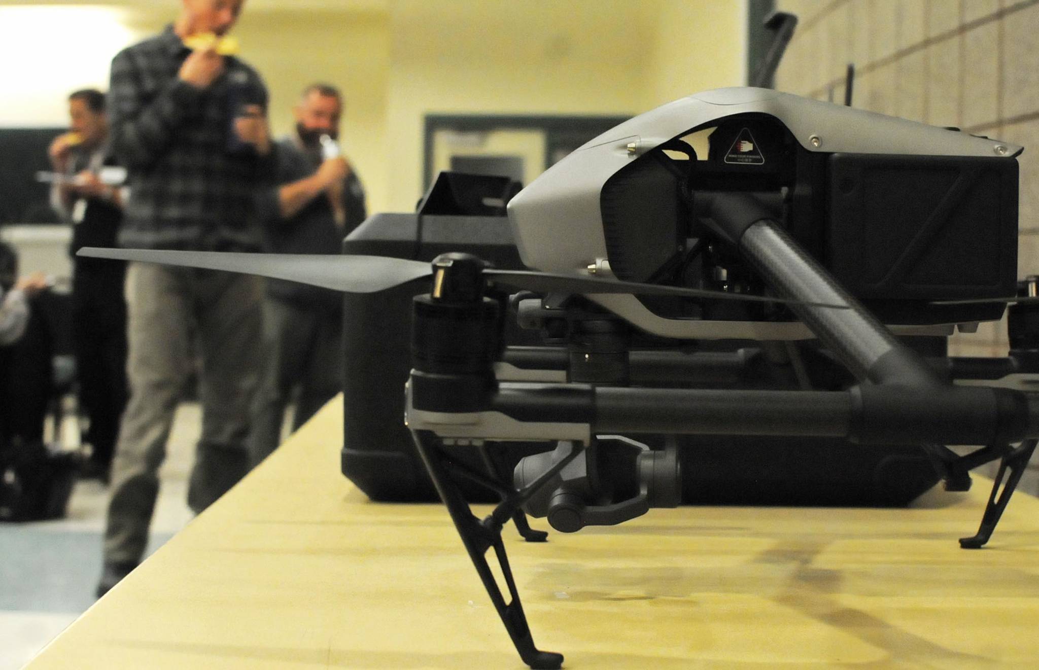
Kenai Peninsula professionals are starting to look at using unmanned aerial vehicles for industries ranging from real estate to ecosystem management.
A crowd of about 50 professionals from around the peninsula got a glimpse into how businesses and agencies are using unmanned aerial vehicles, or drones, at a conference organized by the Kenai Peninsula Borough’s Lands Department in Kenai on Tuesday. From fisheries management to city planning to real estate, the attendees listened to drone pilots and business owners get into the technicalities and various uses for the systems.
Drones are any aircraft without a human pilot aboard and can carry cargo, take pictures and stream video, among a variety of other uses. They’re useful for tasks that are unsafe for humans or even just mundane, said Roger Koppes of Gemini Aeronautics, a digital camera service using drones based in Kenai and in Fort Collins, Colorado.
“Dull, dirty and dangerous are here terms you’re going to hear (about drone use),” Koppes told the crowd during his introduction.
There are several different kinds of drones, beginning with the basic quadcopters — four-engine systems that control their direction by the speed of each of the four motors. The next step up, octocopters or hexacopters — which have eight and six propellers, respectively — are typically used commercially and can’t fly for as long but have a few more backup propellers in case one fails. Fixed-wing drones, which look more like airplanes, can fly for more time but require more space to take off and land, and another type of drone combines the vertical liftoff of propeller-driven drones with the coasting ability of fixed-wing drones, but they are more expensive.
Koppes explained that drone use is also restricted by the Federal Aviation Administration, which requires drone pilots to have a license and a certificate of authorization to fly anywhere other than uncontrolled airspace. The airspace around Kenai and Homer is controlled and so drones are illegal to fly there without a the right permit. It’s also illegal to fly over people without a specific permit, he said.
“Are people operating in those areas without (a permit)?” Koppes said. “Yes, some of them are. But they’re operating against the law at this point.”
A number of private businesses already use drones on the Kenai Peninsula, including Koppes’ company. Integrated Robotic Imaging Systems, Kenai Creative, AC Productions and HDL Engineering Consultatnts all use drones for various operations, from shooting film footage to surveying potential road routes.
The Kenai National Wildlife Refuge uses them for resource management and situational awareness, as in the situation of a wildfire. Mark Laker, an ecologist at the refuge, said the researchers have been using drones since earlier this year for a variety of projects. Drones proved useful in surveying the skittish Aleutian terns the researchers knew were nesting near the refuge headquarters this summer, in part because the birds are sensitive to foot surveys but didn’t seem to mind the drones, he said.
“We did not observe the terns reacting to the drone,” he said. “We started out at (about) 400 feet and just kept dropping, looking for any sort of reaction … and on our last surveys we were flying 50 feet above them.”
Public agencies follow a presidential memorandum issued by President Donald Trump on Oct. 25 that outlines how they are to use unmanned aerial vehicles. The memorandum outlines the instructions for public agencies to protect civil liberties and privacy, mitigate risks to national and homeland security, and protecting the safety of the American public, critical infrastructure and the country’s airspace. Laker said public agencies strive to be accountable with their use of drones. The refuge currently prohibits the recreational use of drones on its lands.
Privacy is a major concern for drone pilots. Steven Letzring, a licensed drone pilot and owner of the Kasilof-based Kenai Mountain Drone Company, said he had to ask permission from neighboring landowners if he wanted to fly above the nearby property.
Letzring’s company, launched this summer, has done some event footage and real estate photography but also does thermography of houses, showing heat spots. Knowing where heat is most concentrated in a house can help homeowners plan for renovations for better insulation, saving energy over time. There are a lot of potential uses for drones, though, he told conference attendees.
“This is going to save lives, for our firefighters, for our policemen,” he said. “It’s giving us access to information we’ve never had access to before.”
Cody McLane of McLane Consulting, a Kenai-based civil engineering and land-surveying firm, said the business recently purchased a drone to keep up with the direction of the field and was learning how to use it. He said his biggest concern with the expanding use of drones would also be the privacy issues.
“Say we’re going to do a design survey on public infrastructure … (where) you have private property adjacent to it, obviously there’s those concerns,” he said.
Privacy as an element of professional ethics was a point Borough Land Management Officer Marcus Mueller touched on during his introduction to the conference. Though the conference was largely about the technicalities of using drones legally and effectively, he said he expected the privacy issue to come up.
“What this conference is not about is looking over fences,” he said. “…The privacy doctrine in Alaska is summed up in the right to be left alone. In some circumstances this may translate to change of methods, change of space, change of time, or simply don’t fly. The focus of this conference is about the ethical use of drones to collect site information by site managers.”
Reach Elizabeth Earl at elizabeth.earl@peninsulaclarion.com.

