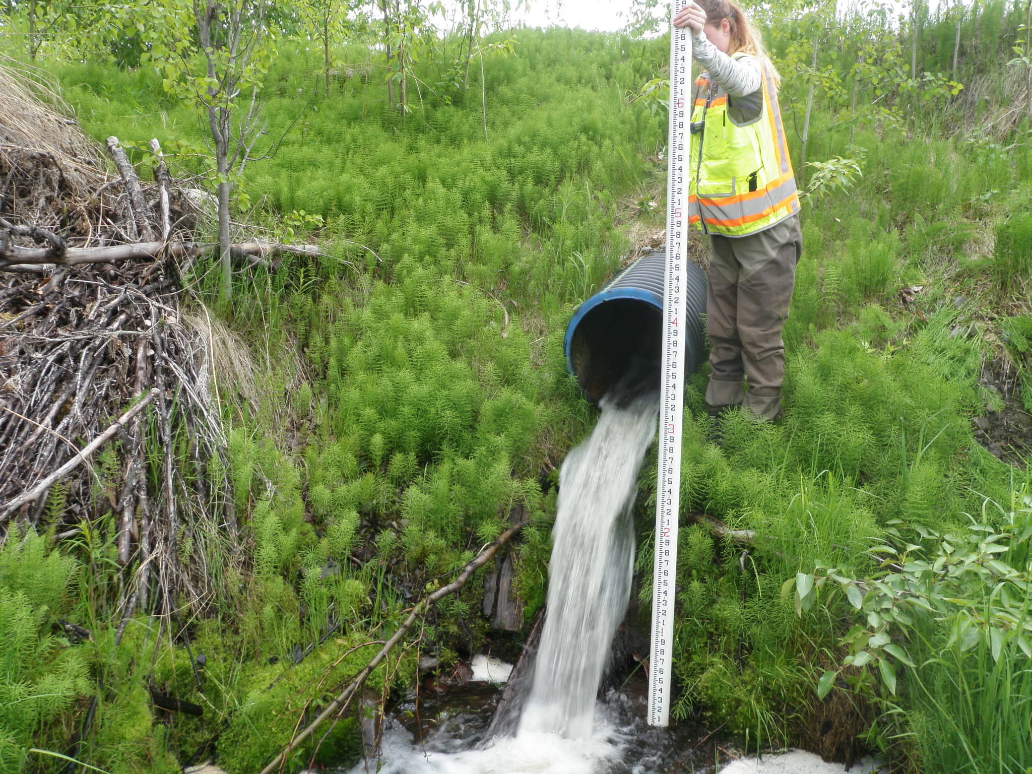
The habitat restoration folks in the Kenai Fish and Wildlife Conservation Office had a summer mission. The challenge posed, which we chose to accept, was to identify and list all stream crossings within the twenty Kenai Mountains-to-Sea corridors on the Kenai Peninsula and evaluate as many of them as possible for fish passage.
So what exactly are Mountains-to-Sea corridors? They are twenty anadromous stream corridors that begin on federally-managed lands and pass through private lands as they flow to the sea. Our beloved Kenai River is one of the twenty, but so are the Moose, Kasilof, Fox, and Resurrection Rivers and smaller creeks including Beaver Creek and Seven Egg Creek. Combined, these corridors alone contain 55% of all stream miles on the entire Kenai Peninsula! Additionally, they present a tremendous opportunity for people to collaborate in the restoration and protection of important habitats. By giving these rivers and streams focused attention, local landowners and conservationists are ensuring that people, salmon, and many other fish and wildlife species have healthy habitats to enjoy well into the future.
Stream crossings, and culverts in particular, really catch our attention. Surveys have shown that thousands of Alaska’s culverts—think everything from under highways to under your driveway—can block movement of adult and juvenile salmon during all or portions of the year. This is a big problem not only for adults trying to migrate to optimum spawning areas, but it is also a problem for juvenile salmon that swim throughout streams on a daily basis to find food and shelter. These fish will travel hundreds to thousands of miles up and down freshwater corridors during their lifetimes.
Ensuring that fish can move unimpeded among important habitats is a critical step in supporting salmon populations and in turn all of the species and habitats that depend on them. Furthermore, if a culvert is serving as a barrier to fish, it often poses a road maintenance and public safety concern as well, particularly during flood events. Appropriately sized and placed culverts benefit the people relying on those stream crossings as well.
With help from our friends at the Kenai Watershed Forum, we visited over 60 culverted stream crossings on both sides of the Kenai Mountains from May through August this year. At each site we collected a variety of data including the type, dimensions, and condition of the culvert. We also collected data on the size and gradient of the stream, the substrate present, and the surrounding habitat characteristics. We placed minnow traps both upstream and downstream of the crossing to assess the fish species that were present in the stream at that particular time. The protocol used was developed by the Alaska Department of Fish and Game (ADF&G), the U.S. Forest Service, and others and has been in use since 2001 to assess culverts throughout Alaska.
Using the data collected, we assigned a site classification for each culvert. Site classifications could be green, gray, or red depending on the amount of fish passage provided at the location. Green culverts are those providing juvenile fish with adequate passage upstream and downstream; red culverts are those that likely don’t provide passage during all or parts of the year; and gray culverts most likely serve as a barrier to passage but need additional analysis.
For example, a culvert with an outlet perched 4” or more above the stream would be classified as red (baby salmon aren’t great jumpers). Another example of a red culvert would be one that is too small for the size of the stream resulting in constricted flows, which quickens the water flow making it hard for those babies to swim upstream. Should you be interested in knowing if your favorite culvert has been assessed and classified, check out the fish passage portion of ADF&G Fish Resource Monitor (http://extra.sf.adfg.state.ak.us/FishResourceMonitor/).
The data collected this summer will be submitted to the ADF&G for inclusion in the statewide fish passage database. It will also guide the Service’s local habitat restoration staff as we implement the Fish Passage Program, which provides funding and staff time for projects that restore fish passage and habitat connectivity at stream crossings.
Emily Munter is a Fish and Wildlife Biologist at the Kenai Fish and Wildlife Conservation Office in Soldotna. Find more information about the KFWCO at https://www.fws.gov/alaska/fisheries/fieldoffice/kenai/ and the Fish Passage Program at https://www.fws.gov/alaska/fisheries/restoration/passage.htm.

