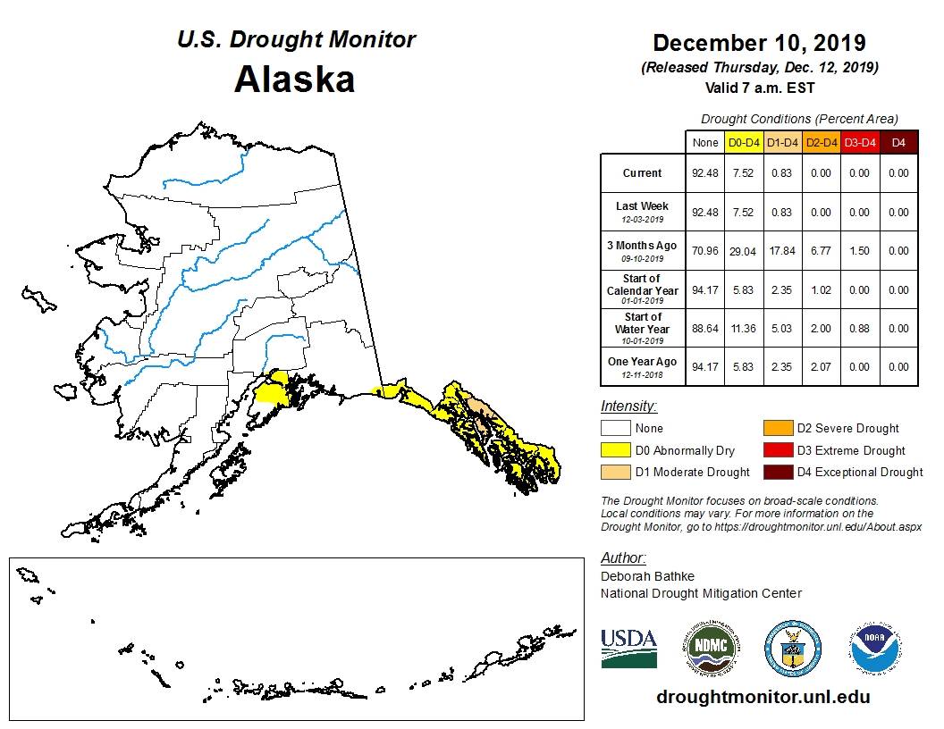
Despite the heavy snowfall and rain the peninsula has received over the last few weeks, the northern half of the Kenai Peninsula is still being considered “abnormally dry” by the U.S. Drought Monitor.
The U.S. Drought monitor map and summary, updated Dec. 12, says that while precipitation was above normal for the Kenai Peninsula, longer deficits are still present and snow pack remains below normal.
The Kenai Peninsula was first categorized by the U.S. Drought Monitor as abnormally dry on July 9.
By July 16, the entire peninsula was placed in a level one drought. By the Aug. 13 monitor map, the eastern peninsula was placed into a level two drought, known as a severe drought.
On Aug. 20, the area around the Swan Lake Fire, just north of Sterling, was placed into a level three drought, known as an extreme drought. The extreme drought wasn’t downgraded until Sept. 24.
The U.S. Drought Monitor provides a state-by-state list of potential impacts for each level of drought. All states and Puerto Rico are included, except for Alaska, where droughts are unprecedented.
The U.S. Drought Monitor — produced in partnership with the National Drought Mitigation Center at the University of Nebraska-Lincoln, the United States Department of Agriculture and the National Oceanic and Atmospheric Administration — measures droughts using five levels — level zero being abnormally dry conditions with no drought, and the fourth level being an exceptional drought.
The U.S. Drought Monitor Map is updated every Thursday.

