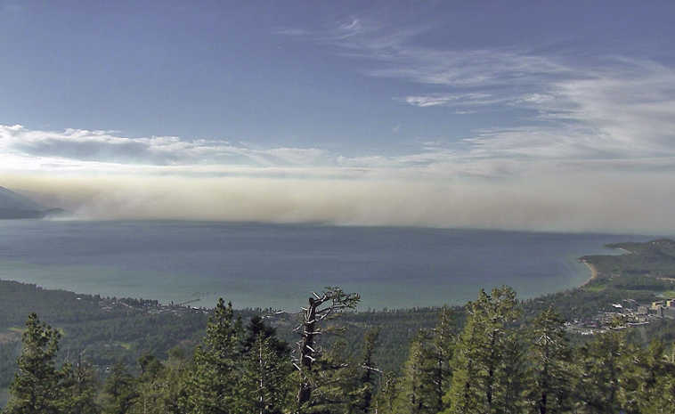
RENO, Nev. — For decades, forest rangers in wooden towers across the West scanned the horizon with binoculars for smoke that could signal the start of a wildfire.
Now, scientists in Nevada and California are helping federal land managers develop technology to expand a network of high-definition cameras to do the job, including one in northern Nevada that recently captured a blaze in real-time more than 100 miles away in Oregon.
The latest project led by the Nevada Seismology Laboratory began two years ago at Lake Tahoe in conjunction with the Forest Service and other local agencies. In recent weeks, the Bureau of Land Management has mounted four cameras on remote mountain peaks stretching from central to northeast Nevada about 100 miles from the Utah line.
“With the system we have developed here in Nevada and eastern California, I think we are on the cusp of a new era in the way we fight fires,” said Graham Kent, director of the lab at the University of Nevada, Reno which tied the communication network into the system it uses to monitor seismic activity and climactic conditions.
The goal is to detect fires faster, especially in unpopulated areas where they can burn several hours or even days before anyone reports them. The cameras with pan-tilt-zoom capability provide a 360-panoramic view with infrared night vision and specialized software to track smoke.
“Basically we are developing 21st century fire tower watchers,” Kent said. “Because we have this on-demand time lapse, you can look at the last 15 minutes or hour or six hours and it makes it easy to see the fire go ‘poof.’ We can get on top of these things a lot more quickly.”
Paul Petersen, BLM’s acting state fire management officer for Nevada, said the cameras provide incident commanders better intelligence when allocating air tankers and other precious resources, especially when stretched thin during peak fire season.
“We had a fire last week just south of Battle Mountain and we were able to move fast and send a heavier aircraft response than we would have,” Petersen said. “At that time, there was only one fire, so that was easy. But there are times we’ve got fires all over.”
The camera that picked up that fire — from the top of the 6,500-foot Midas Peak 40 miles north of Battle Mountain, Nevada — is the same one that gave BLM officials a look at the smoke billowing 104 miles north in Oregon’s Jordan Valley along the Idaho line.
Last month, a camera at Lake Tahoe picked up the first wisps of smoke an hour before anyone reported a fire that eventually burned about 25 square miles of forest near Markleeville, California.
Kent believes some of the 254 homes destroyed in south Tahoe’s 2007 Angora fire may have been spared if cameras were in place.
“You still have to go put the fire out, but the fact that it smoldered all morning and into the afternoon, it would have been very easy to see,” he said.
Kent said they’re working with researchers at the University of California, San Diego, which began utilizing cameras for firefighting intelligence in 2002. The new push is to speed detection by not only providing the video feeds to dispatchers but to the public via the Internet.
“The more eyes the better,” said Ken Smith, the UNR lab’s associate director.
California and some other parts of the West still use manned towers, but many have found them to be too costly in remote areas, and Nevada only has one remaining near Caliente, Petersen said.
The Tahoe network includes ski resort cameras used to provide real-time looks at mountain conditions. Fire agencies in other states also utilize private cameras near urban areas, Kent said, but the expansion into such remote areas is unprecedented. They’ll be especially valuable now that the BLM has placed a priority on protecting sage grouse habitat, Petersen said.
“It really demonstrates how the technology can be put out in the wilderness, really far away from anybody,” Kent said. “You don’t have to be next to a university or famous resort. You can build this infrastructure anywhere there is a need to put out fires quickly.”

