It’s no secret that wildfires play a significant ecological role in Alaska’s boreal forests, including those here on the western Kenai Peninsula.
Everyone who drives the Sterling Highway through the Kenai National Wildlife Refuge to and from Anchorage can see the effects last year’s Swan Lake Fire had on the landscape. In addition, other recent, large-scale fires such as the 2015 Card Street Fire and the 2014 Funny River Fire may also still be fresh in people’s minds.
Whether they ignite naturally or are human caused, it’s safe to say that wildfires will continue to occur here — it’s not a question of whether, but rather when — so a management strategy for dealing with fires before they occur is crucial.
Fire behavior and the severity or effects of wildland fires largely depend on the vegetation type and the weather and climactic conditions prior to and during the fire.
In general, continuous stands of black spruce burn the most aggressively. Any deciduous-conifer mix such as a mixed stand of spruce and cottonwood trees will burn less intensely.
Precipitation, wind, temperature and relative humidity are the primary weather variables affecting fire dynamics. In Alaska, the amount of moisture in the surface organic soil layer, or “duff,” also plays a key role.
In preparation for future wildfires, interagency fire and land managers on the Kenai Peninsula have worked cooperatively to develop and implement “strategic fuel breaks.”
The U.S. Fish and Wildlife Service is working with a variety of stakeholders, such as the Alaska Division of Forestry, Kenai Peninsula Borough, Cook Inlet Region, Inc. (CIRI), Chugachmiut, Alaska Department of Fish & Game, U.S. Forest Service and private landowners to identify calculated and effective fuel break locations.
The overall goal is to place these fuel breaks in areas where it makes the most sense to use natural or manmade barriers to help stop the spread of a wildfire from burning into a populated area regardless of jurisdictional ownership.
You can think of a fuel break as a pre-constructed “line in the sand” that provides firefighters with open space to safely operate as they implement measures to protect communities from an advancing fire.
Constructing these wide fuel breaks is labor-intensive and time-consuming, and therefore is not possible within the time constraints of an active fire. Creating these fuel breaks before a fire occurs increases the decision space and options for fire managers.
Vegetative fuels within the fuel break are not removed, but rather rearranged into a state that reduces fire behavior from a crown fire with the possibility of 100- to 200-foot flame lengths into to a more manageable surface fire, with flame lengths of about 1 to 2 feet.
These areas can be safely accessed by firefighters and be used as prebuilt, indirect containment lines. Wildfires can be steered away from areas of human populations while allowing for natural, necessary processes to occur in undeveloped areas.
Currently, several fuel break projects have been completed on refuge, borough, state, CIRI and private lands within the “wildland urban interface.” That interface is those lands lying along the boundaries of the refuge and private lands. They have effectively been used to protect communities during recent wildfires.
These fuel breaks were constructed at the outskirts of populated comm — unities where the risk of a wildfire was deemed the greatest due to the vegetative characteristics. An example is the Sterling Fuel Break, under construction since 2016, which now covers about 12 miles along the wildland urban interface between Sterling and the refuge.
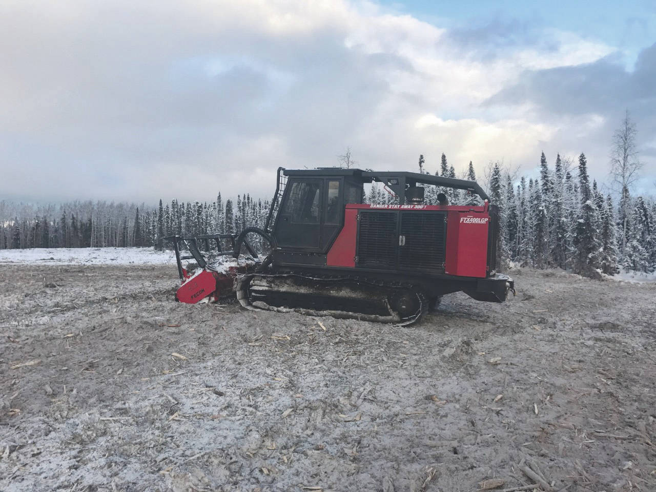
The break is approximately 300 feet wide in most places and was constructed using a variety of tools, methods and resources. The majority of the treatment was completed using a mastication machine, which chops and grinds vegetation into small chunks that are packed tightly to the ground.
The next phase of work is a proposed extension of the Sterling project, named the Kenai Fuel Break. This break would be approximately 8 miles long and 300 feet wide, located on refuge land approximately 8 miles northwest of the community of Kenai, roughly connecting an area between Spirit Lake road and Marathon Road, buffering the existing Homer Electric and Enstar natural gas utility corridor.
This area has been identified because a manmade barrier has already been established, and buffering out the already-in-place corridor will have the best chance of success with the minimum amount of further disturbance to the surrounding habitat. This break would be constructed using mostly heavy equipment in the winter months, when equipment can be supported by frozen conditions over the soft ground.
One of the unique features of this area is the large amount of beetle killed spruce trees within the proposed unit. Treatment of these areas would require felling of dead trees. Other areas will be treated using a masticator.
Some areas will be too steep for heavy equipment, so hand thinning and piling by chainsaws will be required. The project will take several years to complete.
While the purpose of these efforts is to strategically protect communities around the Kenai Peninsula, we also encourage every homeowner to “Firewise” their properties to protect themselves and others. This work should be done before a fire occurs as well. If you wait until a fire occurs to protect your home and property, it may be too late.
Nate Perrine serves as the Fire/Fuels Technician for the Southern Alaska Refuges Zone. Find more Refuge Notebook articles (1999–present) at https://www.fws.gov/refuge/Kenai/community/refuge_notebook.html.
By NATE PERRINE
Kenai National Wildlife Refuge

