By JOHN MORTON
Ohio experienced a record-high temperature of 89 degrees last week as I was driving from Cleveland to Vermont. Strangely enough, I was listening to a podcast about thawing permafrost in Fairbanks, specifically in a tunnel at the Cold Regions Research and Engineering Laboratory. This tunnel is roughly 50 feet underground and 360 feet in length.
Named the Permafrost Tunnel Research Facility, this tunnel literally carves through 40,000 years of the tail end of the Pleistocene and all of the Holocene. You can see intact willows and grass, frozen timelessly, alongside the remains of steppe bison and mammoths. I encourage you to peak at the photos and videos on their website.
This facility was dug during 1963 to 1969 to study underground excavation methods in permafrost. However, it didn’t take long before scientists realized that this underground perspective also lent itself to studying geology and paleoecology in a “living” laboratory. Seriously. A bacterium, now called Carnobacterium pleistocenium, sat frozen for 32,000 years until 2005, when it started swimming around after being thawed from this tunnel.
What is permafrost? It is simply ground that remains at or below freezing for at least two consecutive years. Twenty-four percent of the Northern Hemisphere has permafrost, but 80 percent of Alaska has permafrost.
However, the distribution of permafrost within a landscape varies — it can be continuous (greater than 90 percent), discontinuous (50 to 90 percent), sporadic (10 to 50 percent) or isolated (10 percent). North of the Brooks Range, the ground is continuous permafrost, frozen to a depth of 2,000 feet or more. Most of Interior Alaska has discontinuous permafrost.
Why care about permafrost? After all, it’s just frozen ground. But if you’ve paid any attention to concerns about thawing permafrost in Alaska, you’ll realize that it’s a big deal.
A 2007 study conducted by the University of Alaska Anchorage’s Institute of Social and Economic Research estimated damage from climate change, primarily thawing permafrost effects on road and rail infrastructure, could cost the state $6 billion by 2030.
Thawing permafrost along the Beaufort and Chukchi seas is accelerating coastline erosion. And, if you think the climate is warming rapidly now, consider that the amount of carbon in permafrost, released as carbon dioxide or methane, is twice what is currently in the atmosphere!
Here on the Kenai Peninsula, permafrost is almost nonexistent. A statewide mapping effort by Torre Jorgenson and his colleagues in 2008 indicates that permafrost is absent from the western peninsula except for isolated patches in the Nikiski area. Retired Kenai National Wildlife Refuge ecologist Ed Berg described finding a permafrost pocket in the Kenai Lowlands northeast of Sterling in 2009.
That’s what makes a 2016 study published in the journal, The Cryosphere, so interesting. Authored by Ben Jones at the USGS Science Center in Anchorage and his colleagues, it documents the dynamics of small permafrost plateaus around Browns Lake (east of Funny River) on the Kenai National Wildlife Refuge.
They showed that the ice encountered was indeed permafrost, but barely so, maintaining its temperature just below freezing at minus 0.04 to minus 0.08 degrees Celsius. The permafrost depth ranged from 1 foot to almost 21 feet!
What’s fascinating about this work is that this residual permafrost from a colder era exists in our part of the world where the mean annual air temperature is above freezing, 1.5 degrees Celsius to be exact.
What allows the permafrost to persist in our warming environment is the insulating vegetation layer, composed mostly of black spruce and Sphagnum, that now grows in the unfrozen soil overlying the permafrost.
Just how insulating this vegetation can be was best demonstrated at the permafrost tunnel in Fairbanks. There, three experimental plots were laid out in 1946. One plot was left undisturbed, the second was cleared of trees but their roots and organic material remained, and the third plot was stripped of all vegetation and surface organic material.
The findings after 25 years suggest that partial clearing degraded the permafrost to 15 feet below the surface, while complete stripping degraded permafrost to 22 feet below the surface. In a more recent study, the partially cleared plot had grown back its vegetation and the degradation has stabilized, but the completely stripped site has continued to degrade to 32 feet!
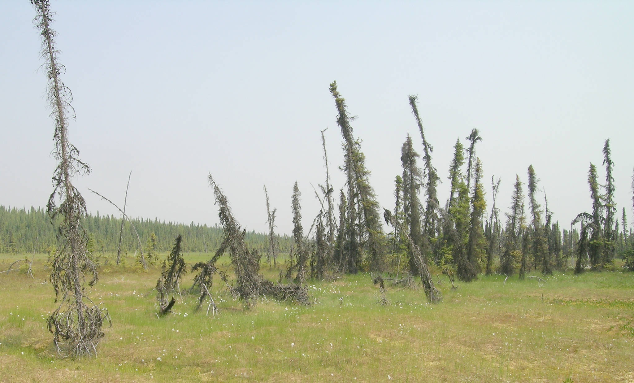
Back on the Kenai, Dr. Jones and his colleagues examined historic aerial photographs. One of the telltale signs of the thawing of permafrost plateaus is that the black spruce growing there starts to tilt, eventually falling over.
They found that 60 percent of the permafrost plateaus present around Browns Lake in 1950 severely degraded by 2010, leading to replacement of black spruce forest by Sphagnum fens or bogs. This loss translates to 1 percent of surface area per year, the second fastest change rate reported to date in the scientific literature on boreal peatlands.
The Kenai Fire burned the Browns Lake area in 1947, which certainly removed some of the insulating vegetation and contributed to loss of these permafrost plateaus. But the rapid thawing of these pockets of permafrost is clearly linked to a warming climate, particularly increasing nighttime temperatures during the winter in recent decades.
We can still freeze the ground several feet deep in a cold winter, but we get it all back in the summer and permafrost never gets started nowadays.
Dr. John Morton is the supervisory biologist at Kenai National Wildlife Refuge. Find more Refuge Notebook articles (1999-present) at https://www.fws.gov/Refuge/Kenai/community/Refuge_notebook.html.

